
Where GIS analysis meets thoughtful cartography.
I’m a GIS analyst with a cartographer’s eye, combining technical problem-solving with a strong sense of clarity, design, and purpose.
Over the past 13+ years, I’ve worked across transportation, water resources, environmental research, and mining to build reliable data, thoughtful maps, and practical GIS tools that help people better understand places, patterns, and decisions.
Selected Projects
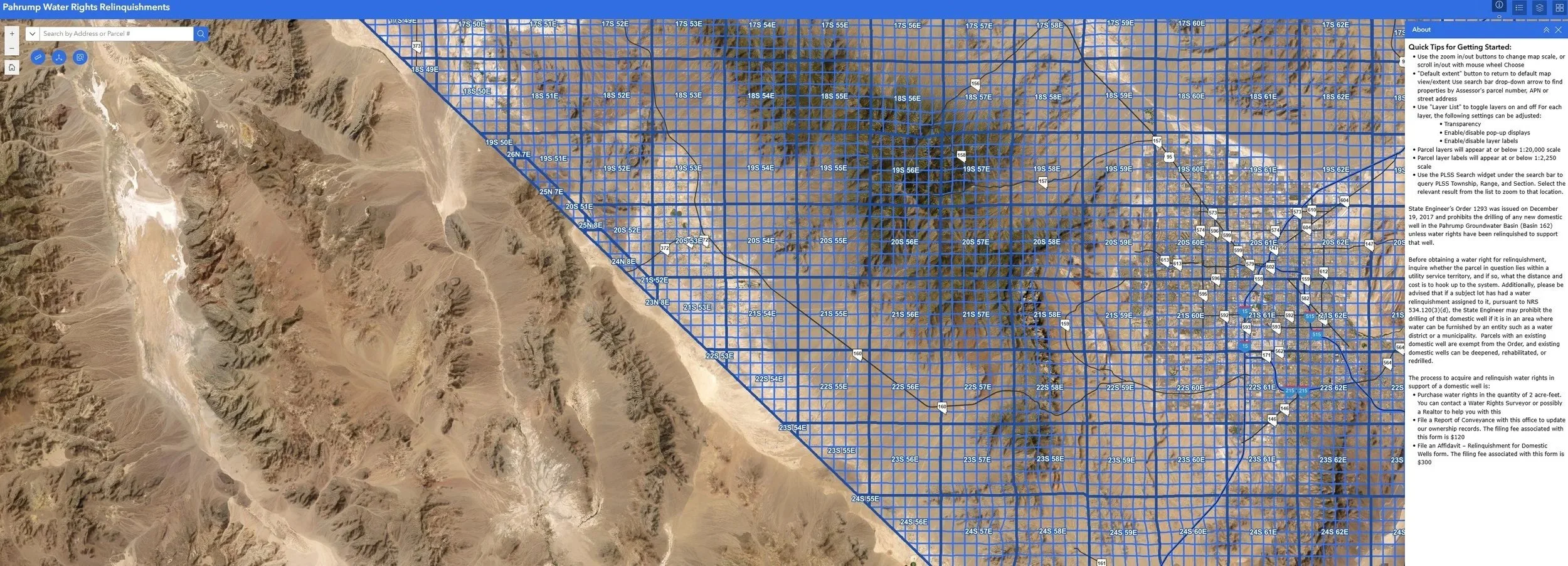
Pahrump Water Rights Relinquishments Web Application
This ArcGIS Experience Builder application provides an interactive way to identify parcels in the Pahrump area where water rights have been relinquished or dedicated. The application combines authoritative parcel and water-resource data within a searchable web map, allowing users to explore individual properties, review associated records, and better understand where water-right removal or dedication has occurred.
Designed for both agency staff and the public, the application replaces a more cumbersome record-search process with a clear, map-based interface. Connected mapping and data tools allow users to search, select, filter, and examine parcel-level information while maintaining the geographic context needed to interpret each record. The result is a more accessible and efficient way to communicate complex water-right information and support property research, regulatory review, and water-resource decision-making.
NDOT Statewide Vector Tile Basemap
I developed a custom statewide vector tile basemap for the Nevada Department of Transportation to support consistent mapping across internal web, mobile, and desktop GIS applications. The project combined authoritative transportation, boundary, hydrographic, land-use, and reference datasets into a single cartographically coordinated basemap designed specifically for NDOT workflows.
The basemap was built with ArcPy scripts, reusable cartographic style templates, custom labeling, and scale-dependent display rules across 14 seamless zoom levels. Each layer was carefully generalized, symbolized, and labeled to maintain clarity as users moved from statewide views to detailed local mapping.
The completed basemap provided NDOT with a standardized alternative to generic commercial basemaps while giving staff greater control over data content, appearance, and update workflows. It now supports Portal-based web maps, mobile applications, field operations, planning, analysis, and other GIS products used by approximately 1,900 internal users.
This project demonstrates the integration of enterprise GIS data management, automation, multiscale cartographic design, and vector tile publishing to create a high-performance mapping resource for statewide operational use.